|
Russia map (1613)
(A printing source: It is made by the Netherlands geographer and cartographer Gesselem Gerritsom. It is published in Asterdame in 1613г.) a WEB-source: the Russian National Library
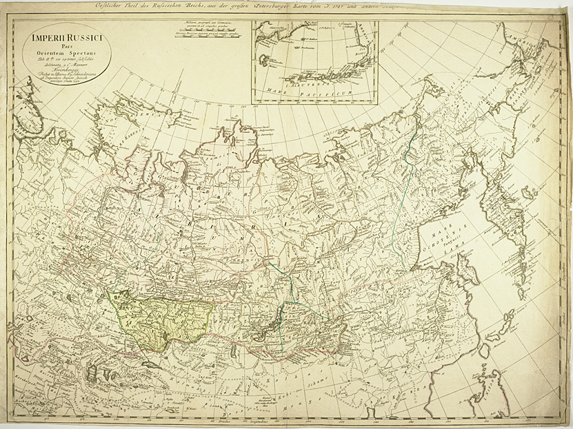
Card of the Russian empire (1794)
(A printing source: Imperii Russici pars orientem spectans. Nuremberg, A.G. Schneideriana, 1794. The Russian empire eastward from the Dvina River, indicating some still unexplored coastlines in Nova Zemlya and northeastern Siberia. Includes a portion of Alaska) a WEB-source: University of Minnesota, Twin Cities
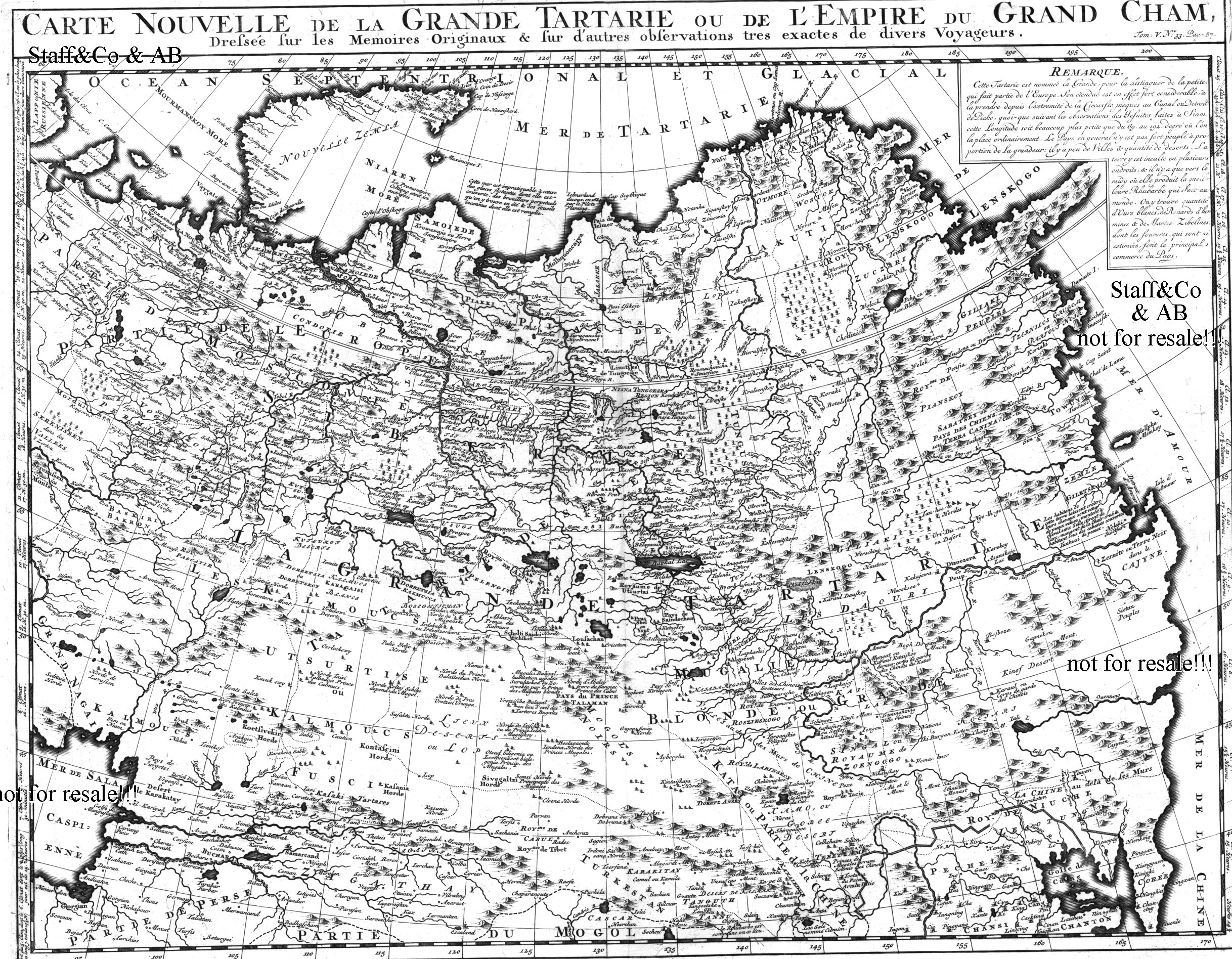
Card of the Russian empire (the beginning 18 century)
(A printing source: Nicolas Vitsen the beginning 18в the Engraving on copper) a WEB-source: AB& Staff&Co
Card of the Russian empire (1820)
(A printing source: From The Cyclopaedia or, Universal Dictionary of Arts, Sciences, and Literature by Abraham Rees, 1820) a WEB-source: UT Library Online
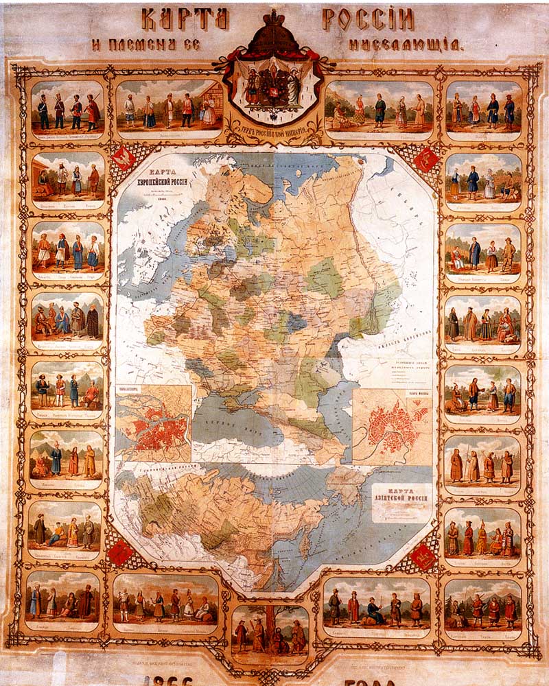
Russia map and its tribes occupying (1866)
(A printing source: Сост. And N.Terbenev's fig.) a WEB-source: the Russian National Library
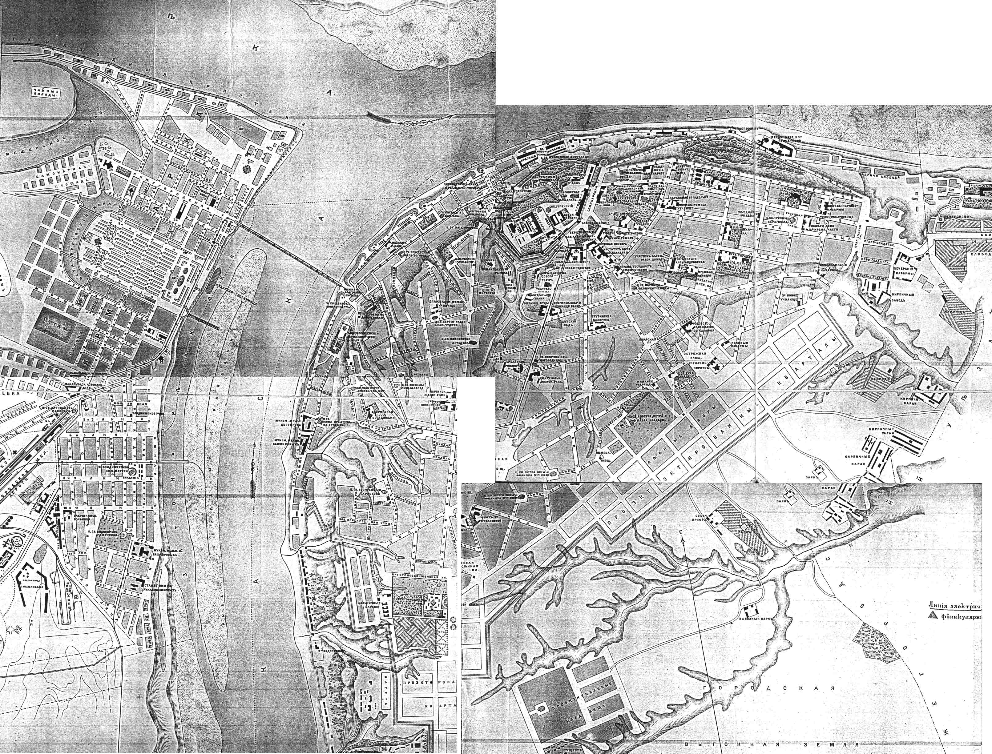
Cards of Odessa
(The edition of a bookshop of E.P.Raspopova)
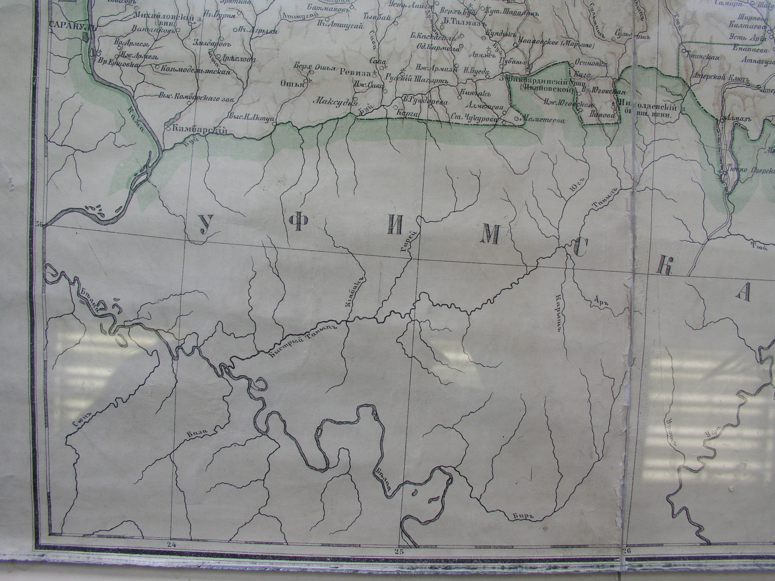
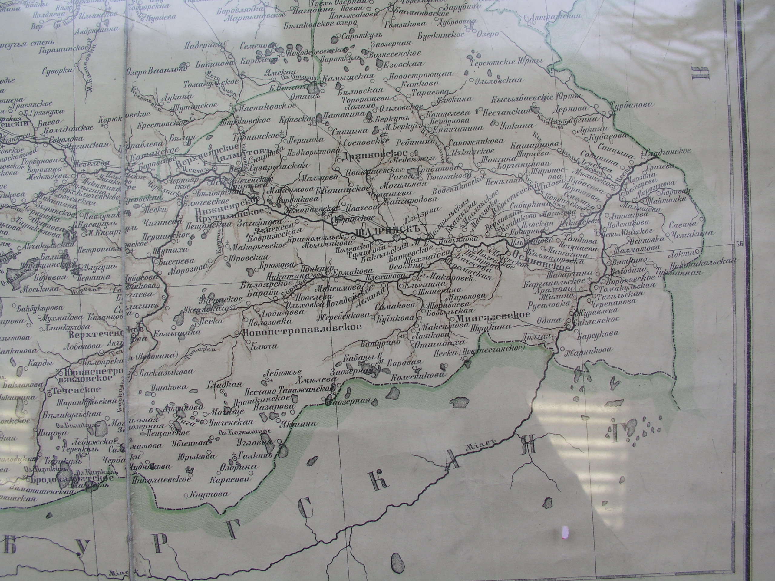
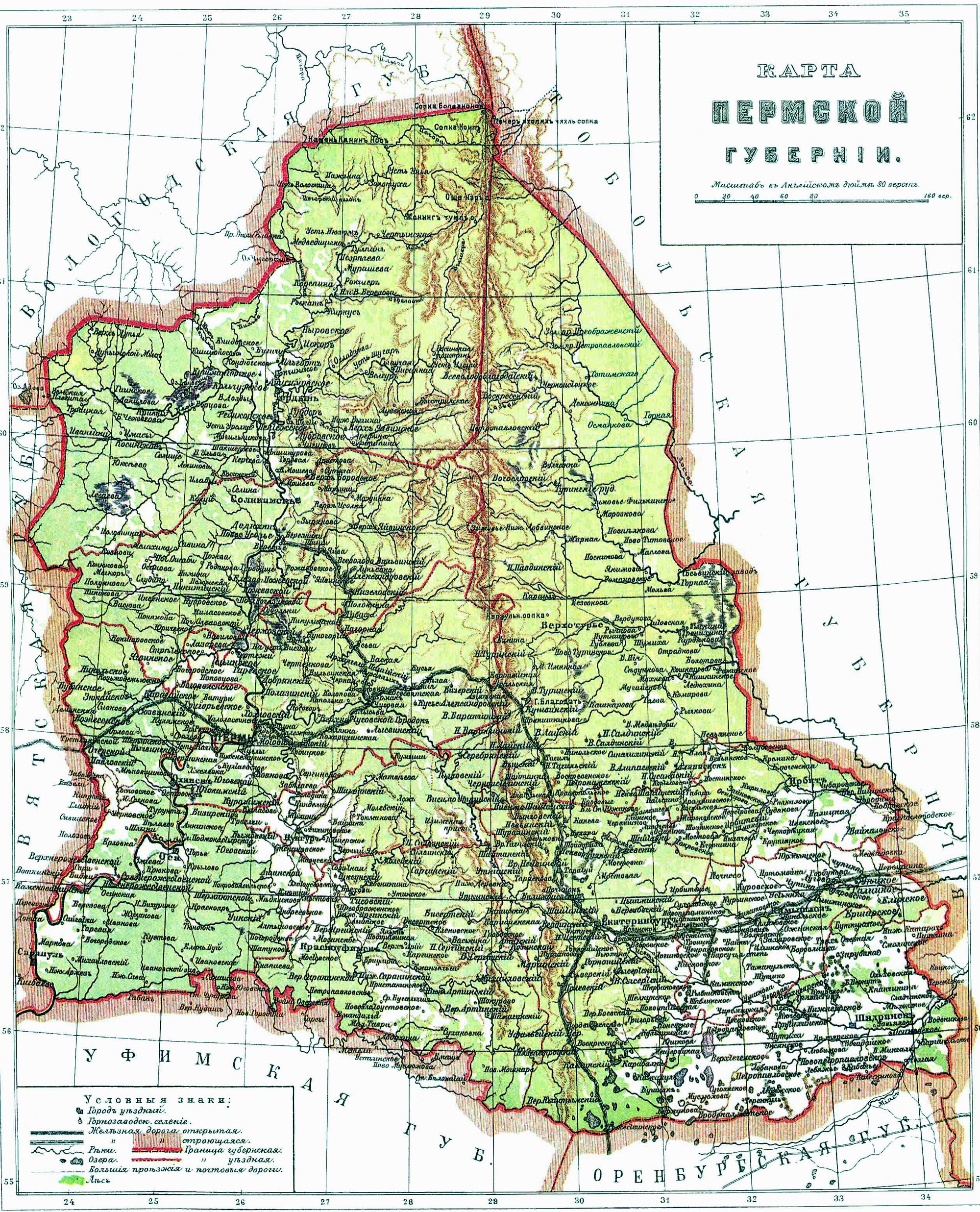
Cards Russian губерней 1869
(The Perm province. From the book "the List of the occupied places according to 1869")
Kazan 1914
(Printing источник:на to a basis of the edition of M.M.Perevoshchikova) a WEB-source: russiamaps
Nizhni Novgorod 1896
(A printing source:?) a WEB-source: the Collection of historical cards of cities
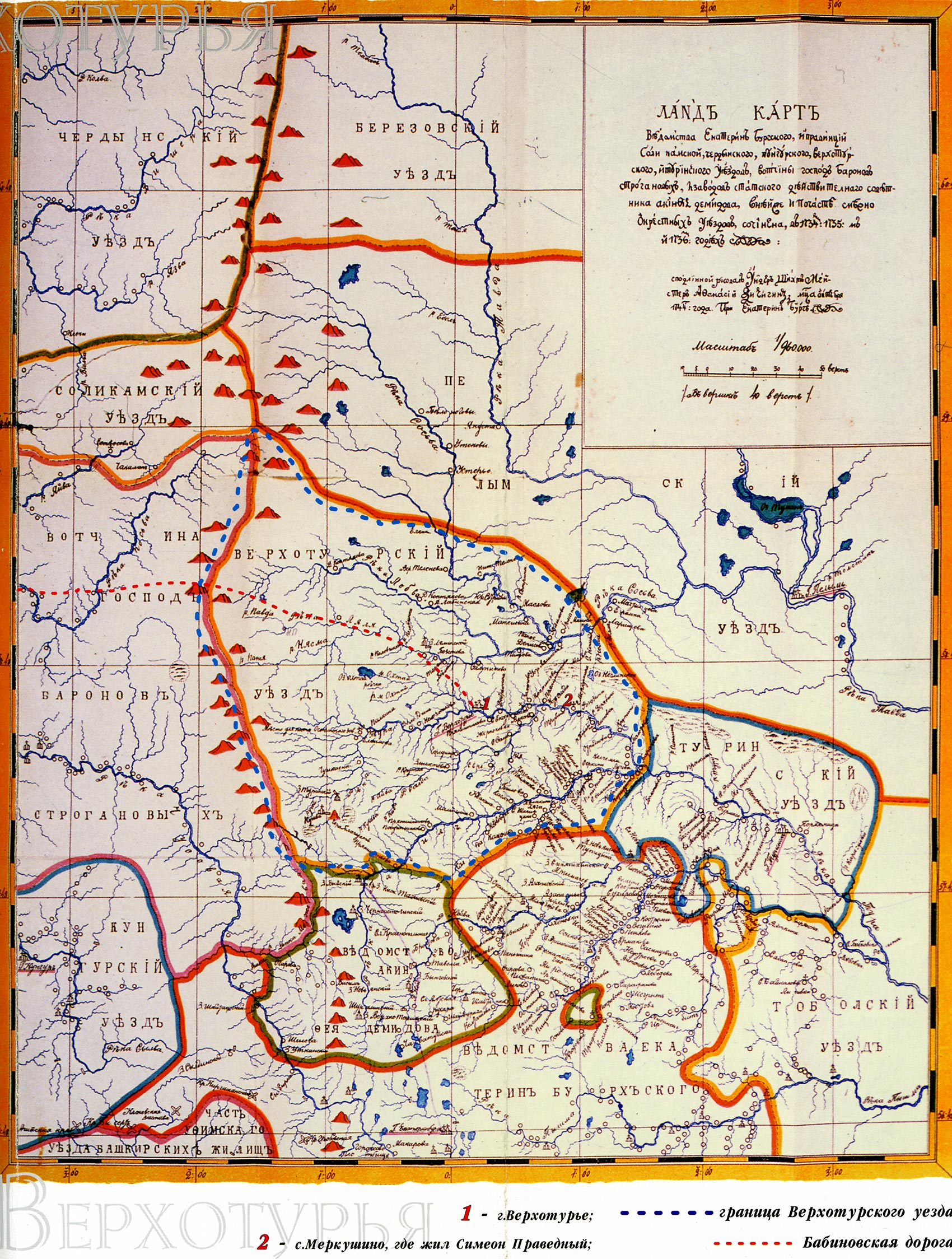
Average and Northern Ural Mountains. 1744г.
(A printing source: the Card is published in the brochure published to 400 летию the cities of Verhoturja) a WEB-source: Cards открестностей Ekaterinburg
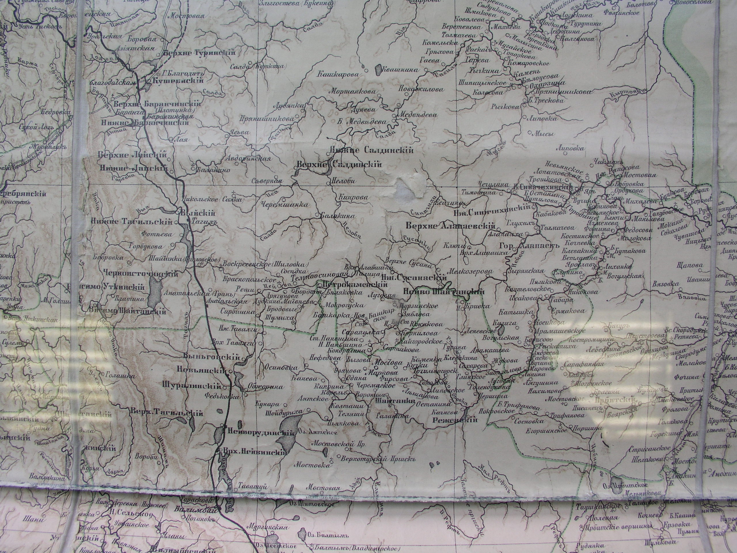
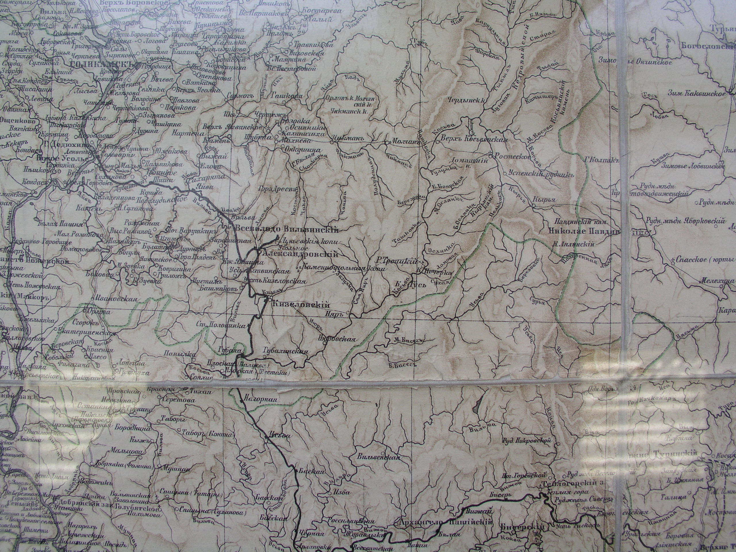
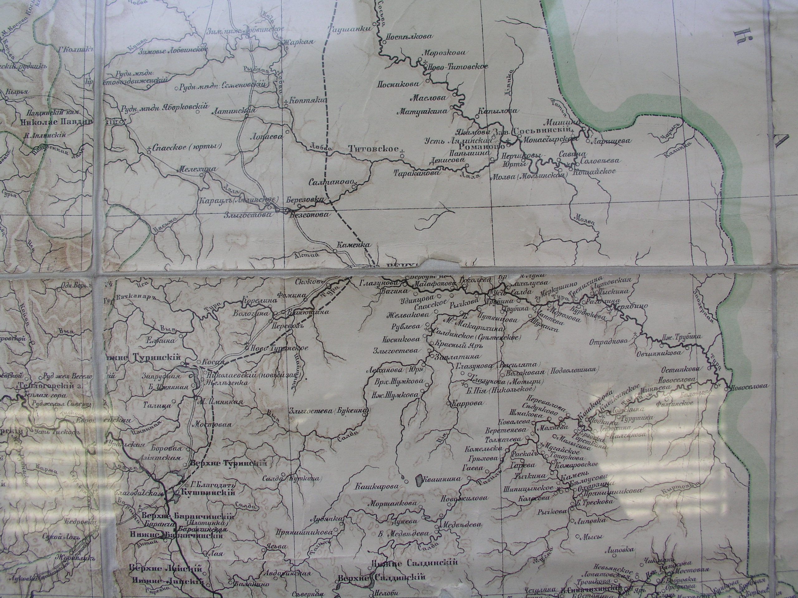
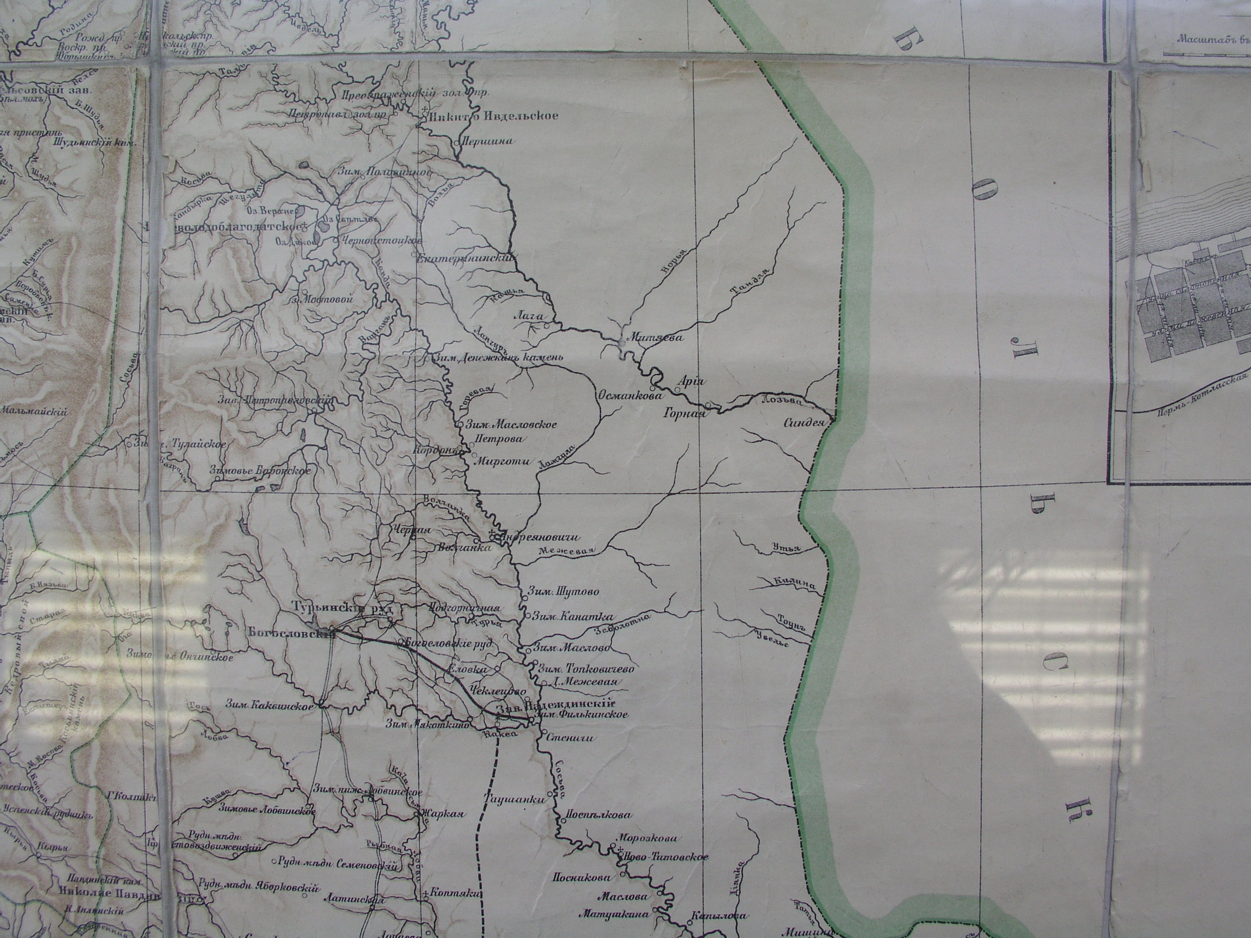
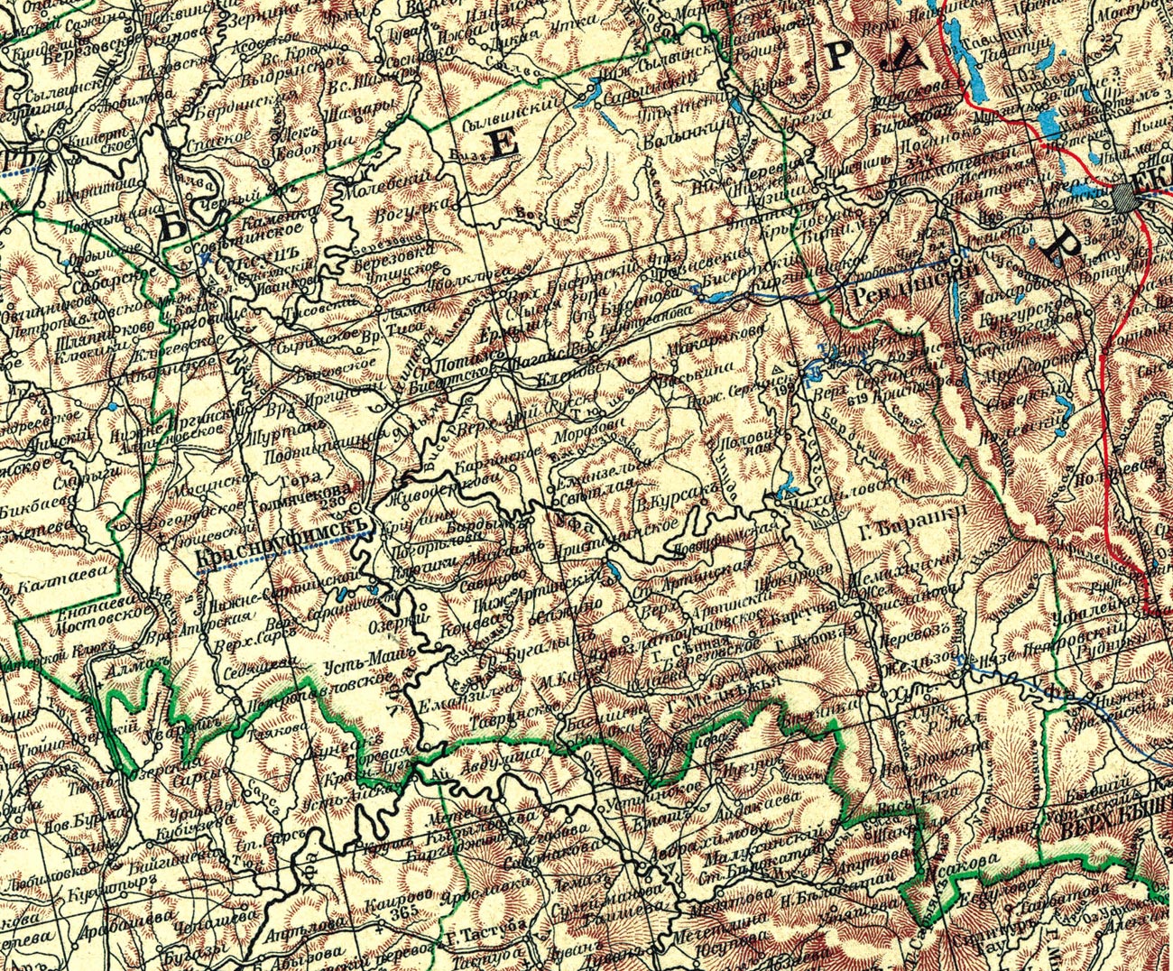
Card of the Ekaterinburg district as a part of the Perm province. 1908г.
(A printing source: the Card of the Ekaterinburg district as a part of the Perm province. The edition of the Ural society of fans of natural sciences. A.Ilina's cartographical institution in S.Peterburge. A buckle, 5) a WEB-source: Cards открестностей Ekaterinburg
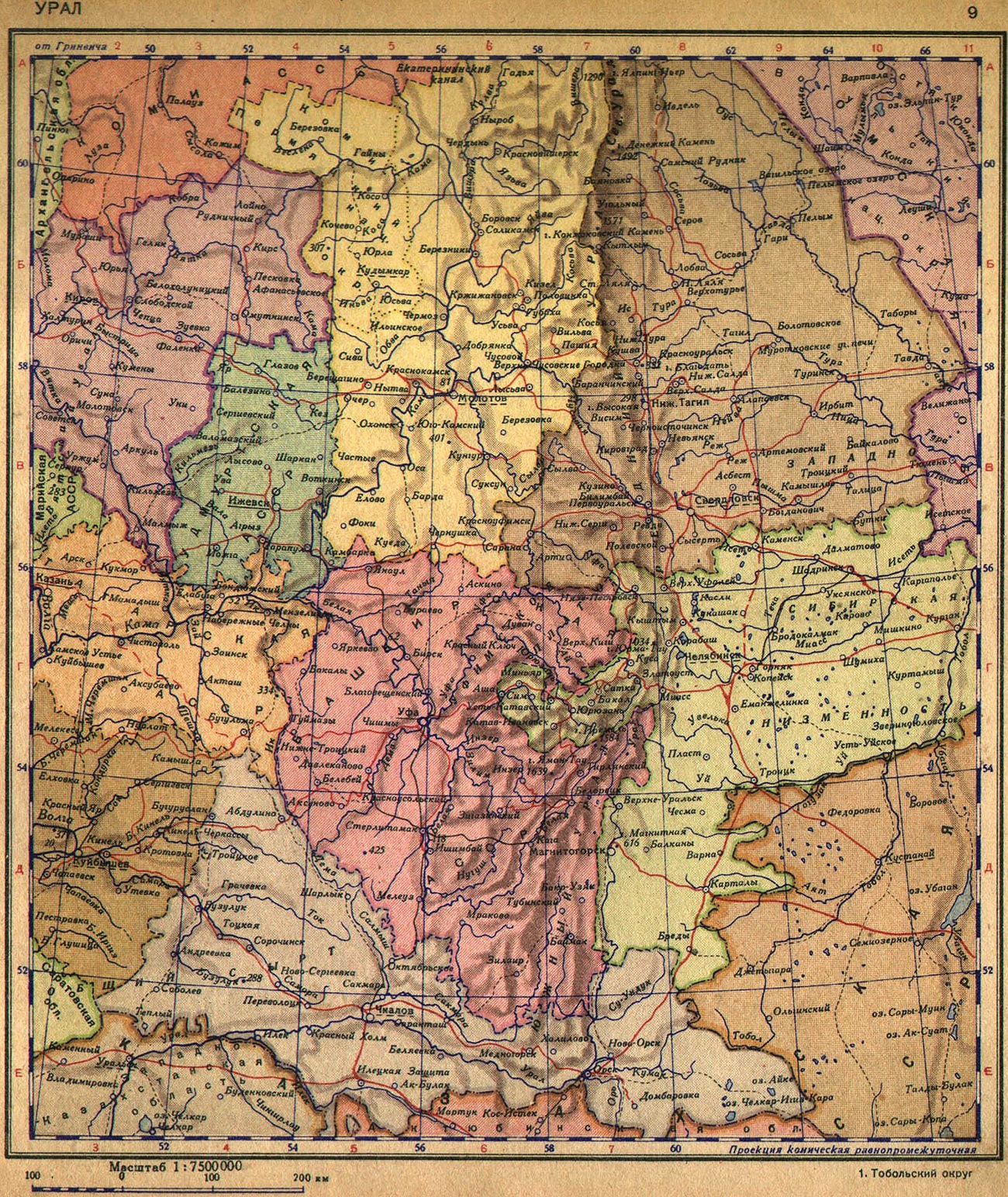
Card of Ural Mountains. 1940г.
(A printing source: It is published in the Atlas of the World, 1940 of the edition) a WEB-source: Cards открестностей Ekaterinburg
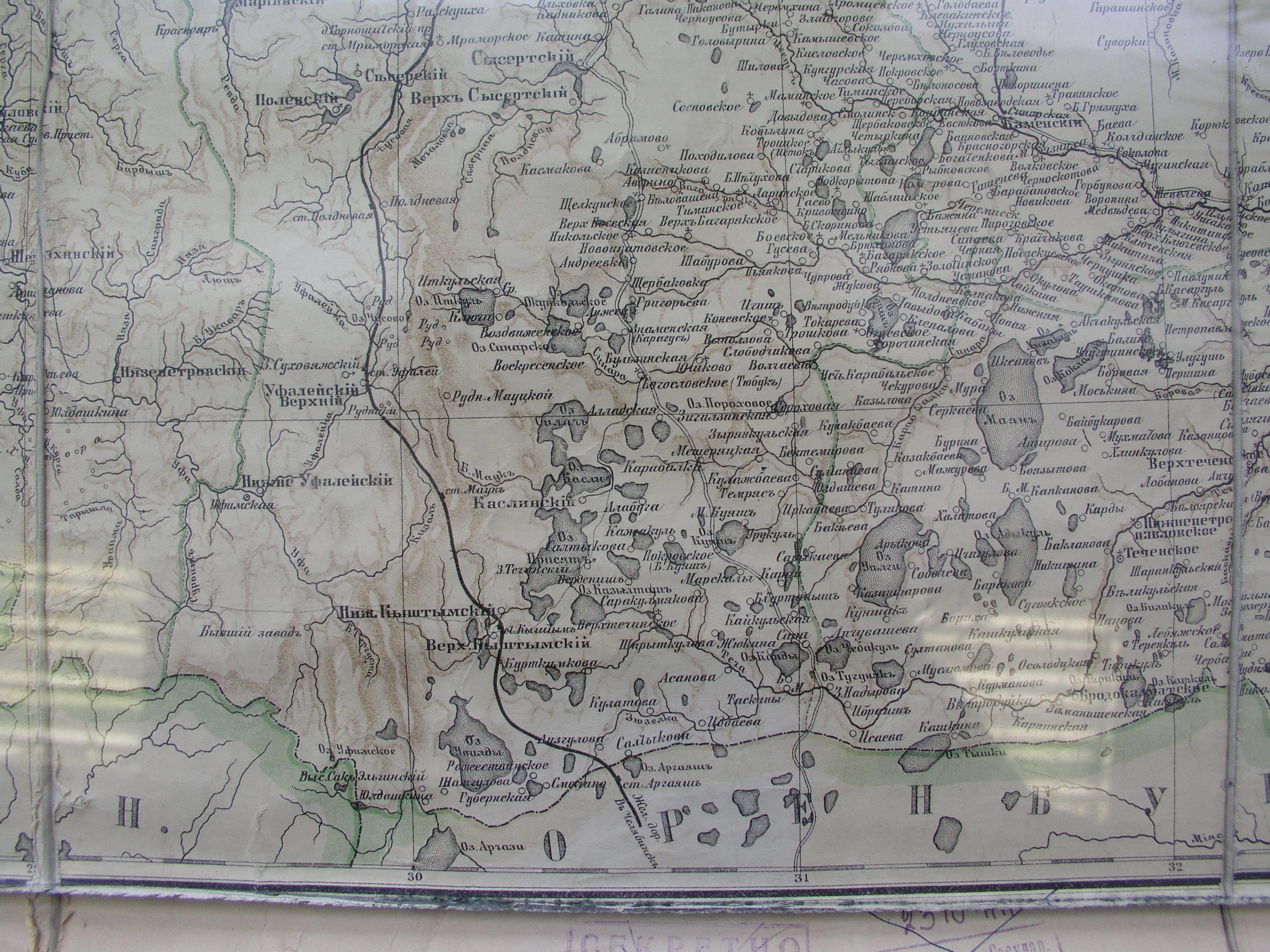
Card of the Ekaterinburg district. 1903г.
(A printing source: the Card of the Ekaterinburg district) a WEB-source: Cards открестностей Ekaterinburg
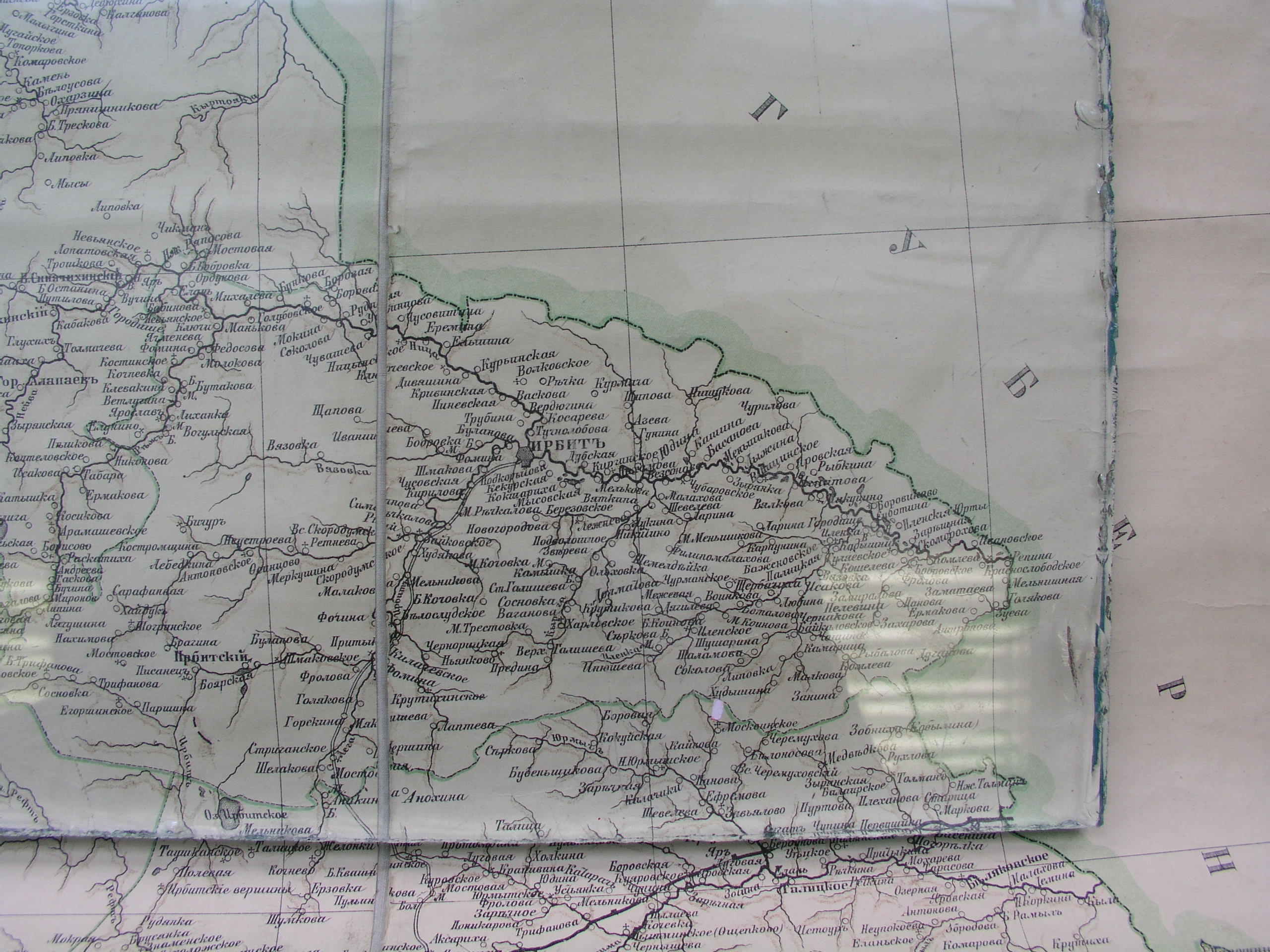
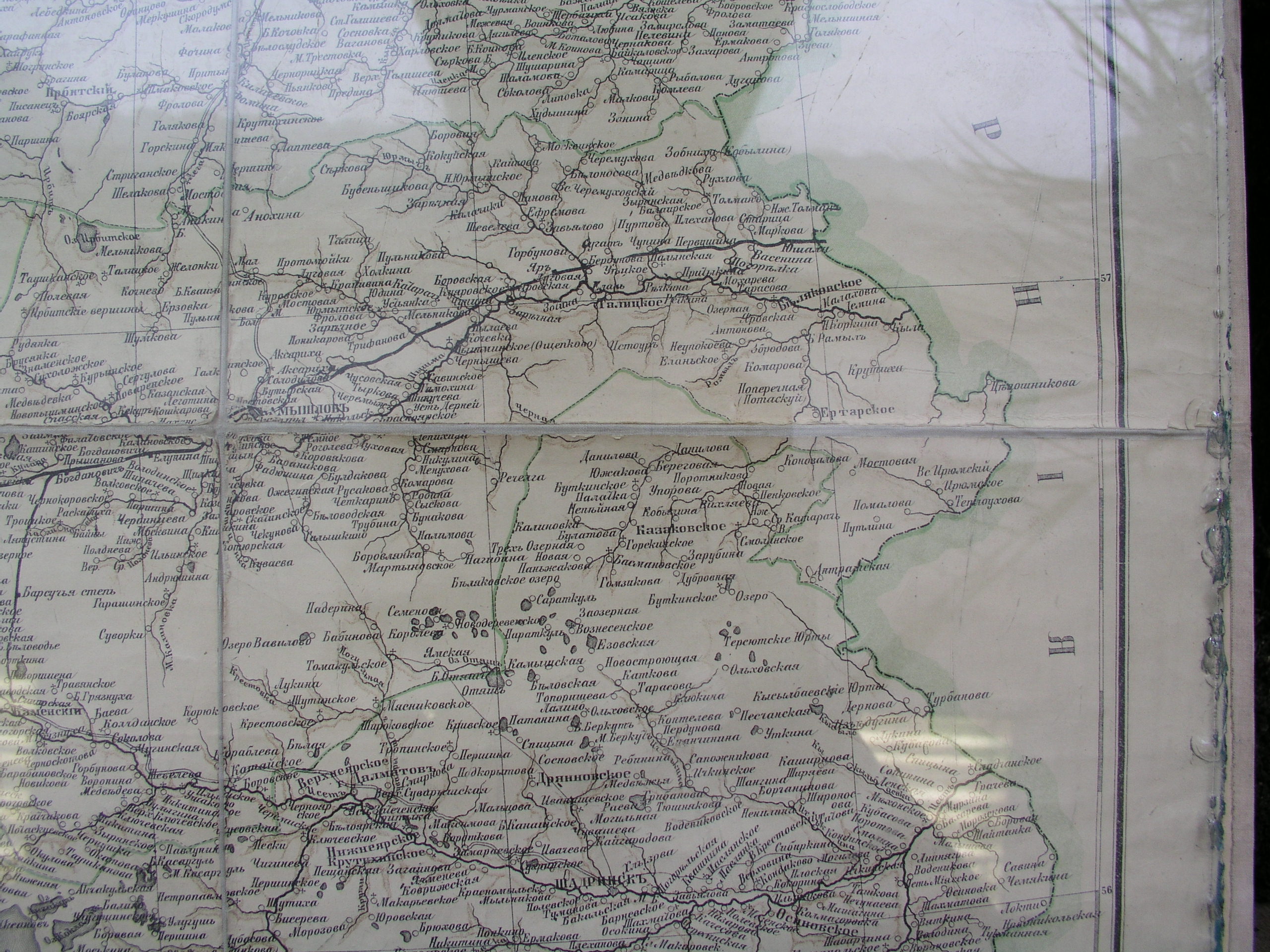
Card of Irbitsky district. 1903г.
(A printing source: the Card of Irbitsky district) a WEB-source: Cards открестностей Ekaterinburg
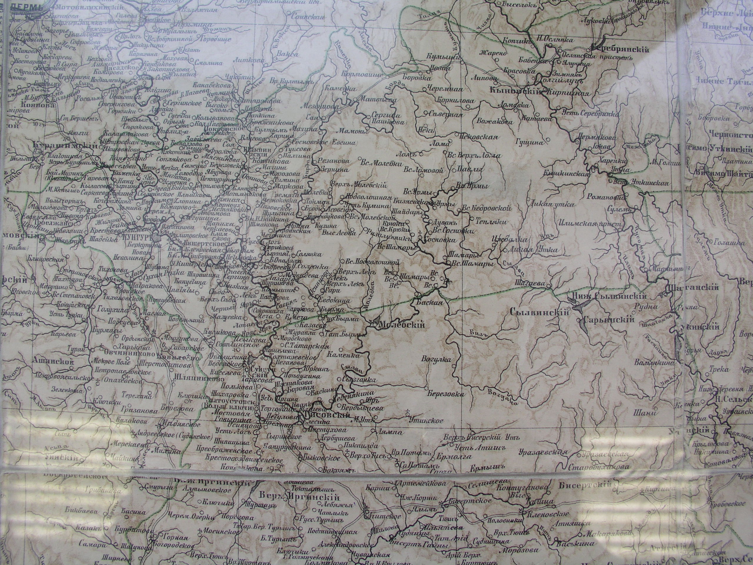
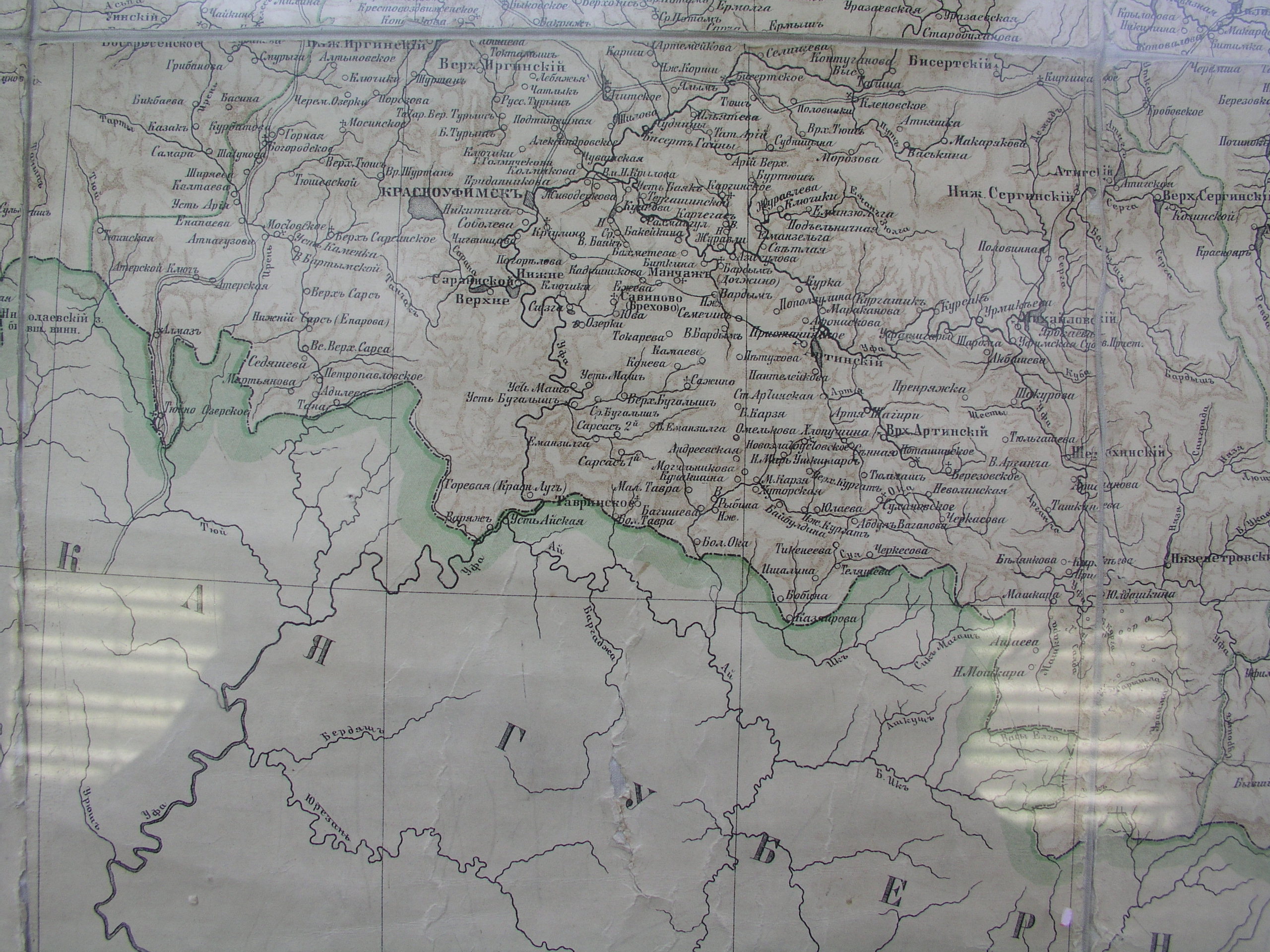
Card of Krasnoufimsky district. 1903г.
(A printing source: the Card of Krasnoufimsky district) a WEB-source: Cards открестностей Ekaterinburg
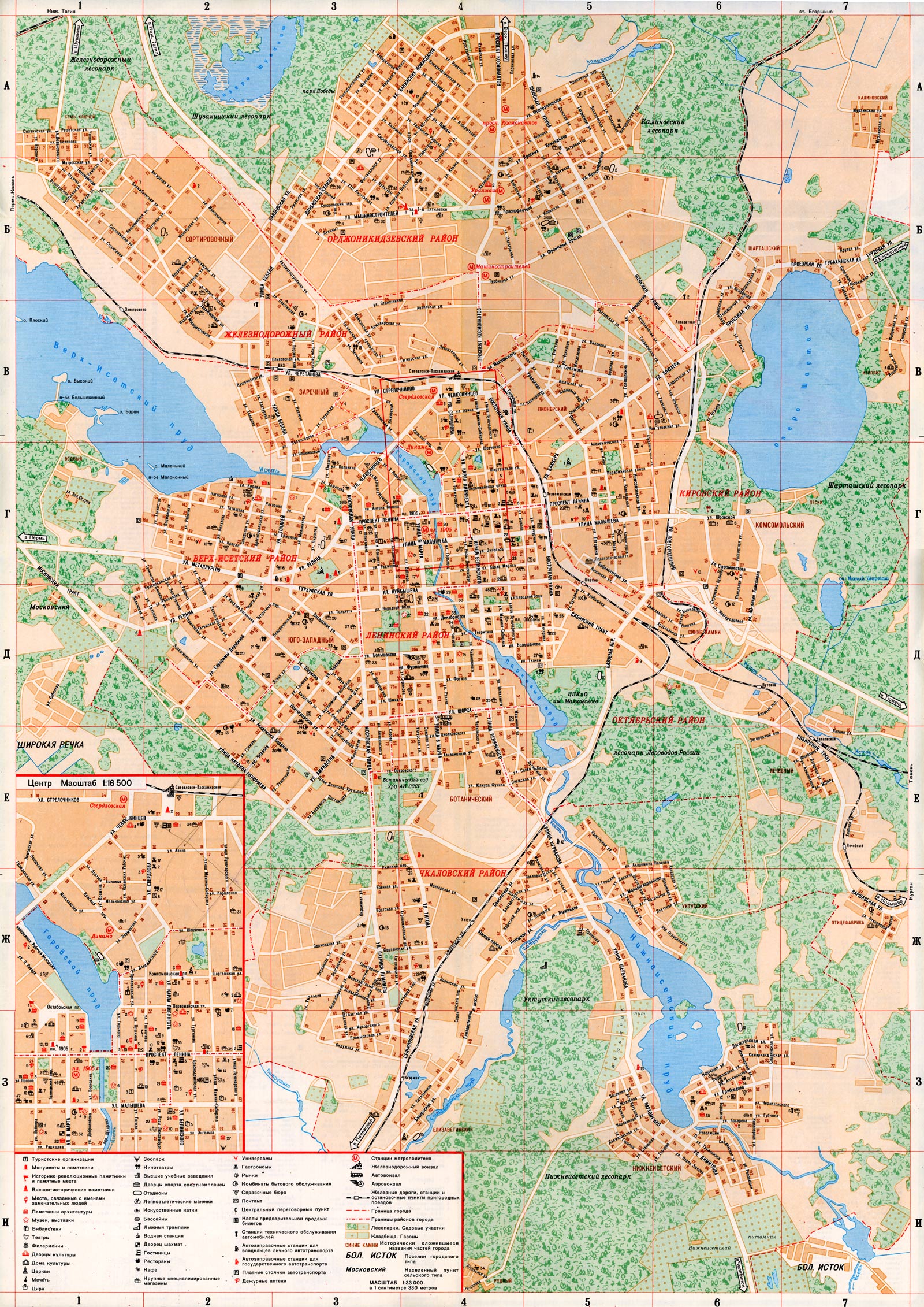
Cards of Ekaterinburg
WEB-source: Екатеринбург+Свердловск
-
Ekaterinburg as a part of the Perm province
(The card was a part of the encyclopaedia Brockhaus and Efron. The encyclopaedia is let out in the end of XIX of the XX-th century beginning.)
-
Card of Ekaterinburg 1991
(The first map of the city after возращения the historical name)
-
Card 1931
(The big colour card of Sverdlovsk on materials of filming 1925-27)
-
Card 1929
(The big card of Sverdlovsk on materials of filming 1925-27)
-
Card 1920
(A city map of Ekaterinburg 1920г. The card is published in the book "Ekaterinburg a city history in architecture". Publishing house "Socrat" 1998)
-
Card 1900
(A city map of Ekaterinburg of 1900.)
-
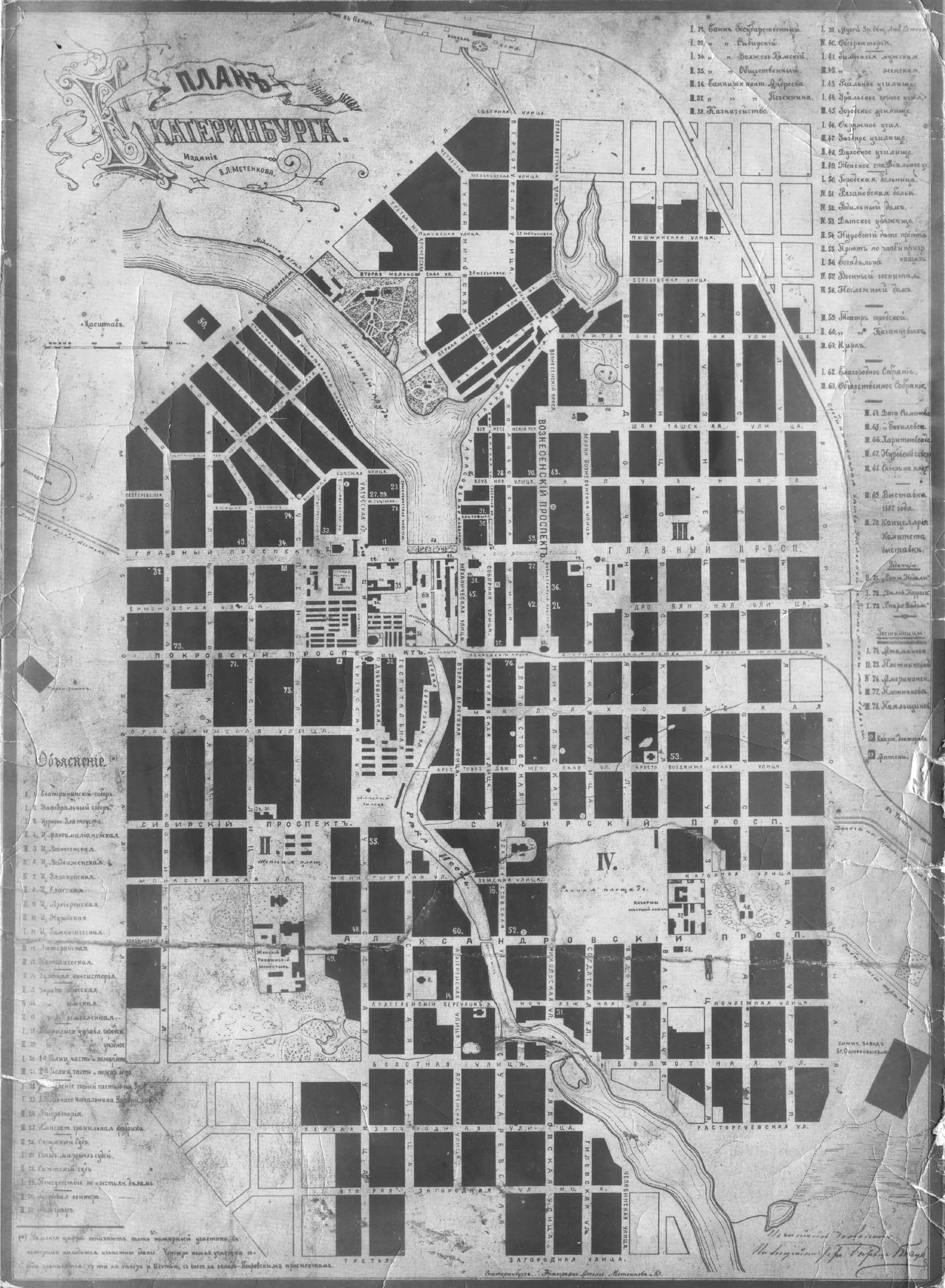
Card of Ekaterinburg, V.L.Metenkova's edition
(The end XIX - the XX-th century beginning.)
-
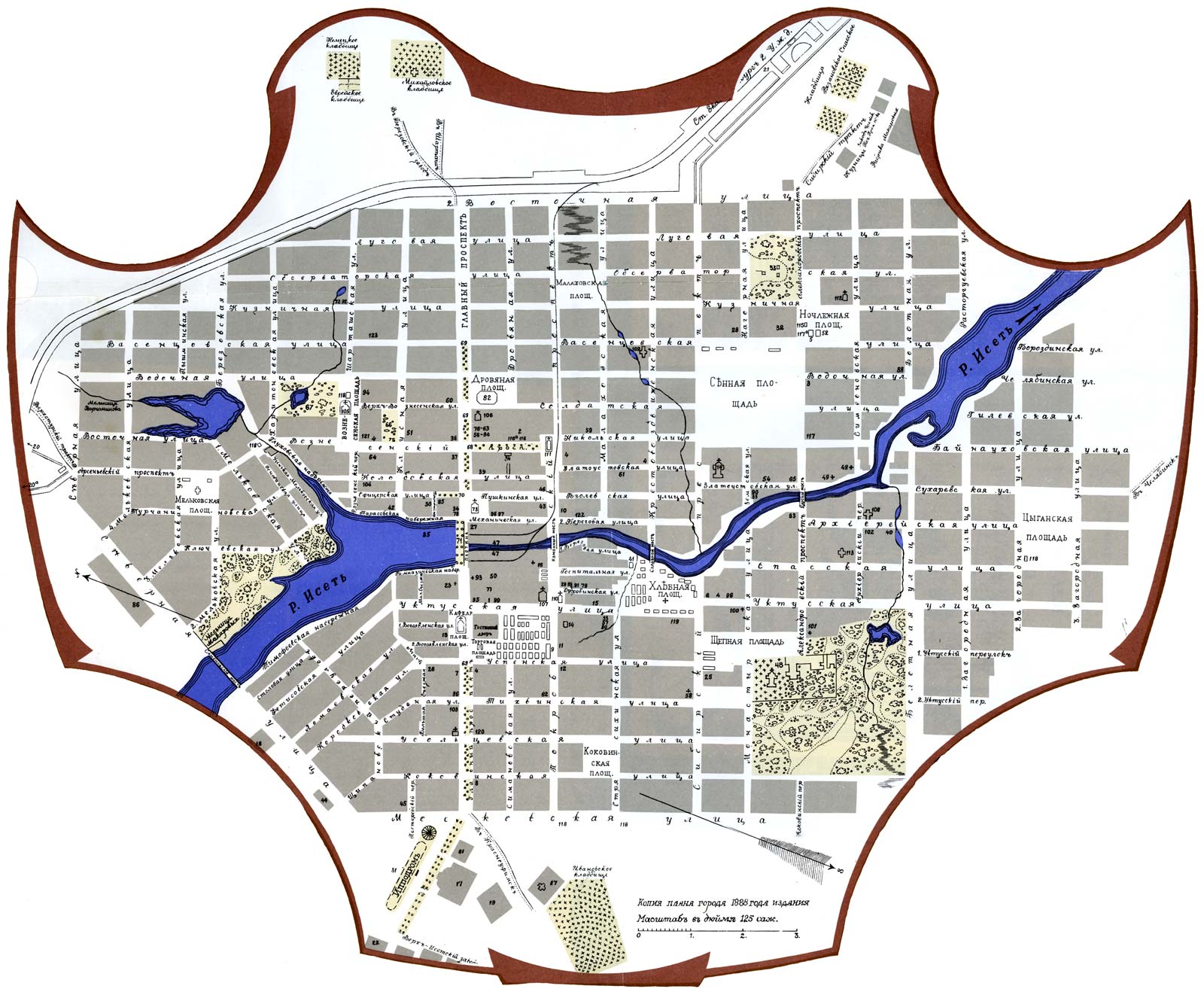
Colour card of Ekaterinburg 1888
(A city map of Ekaterinburg of 1888.)
-
Card 1888
(A city map of Ekaterinburg of 1888.)
-
Card 1829
(A city map of Ekaterinburg of 1829.)
-
Card 1804
(A general layout of Ekaterinburg 1804. The card is published in the book "Ekaterinburg a city history in architecture". Publishing house "Socrat" 1998)
-
Card 1780
(A city map of Ekaterinburg of 1780th years. The card is published in the book "Ekaterinburg a city history in architecture". Publishing house "Socrat" 1998)
-
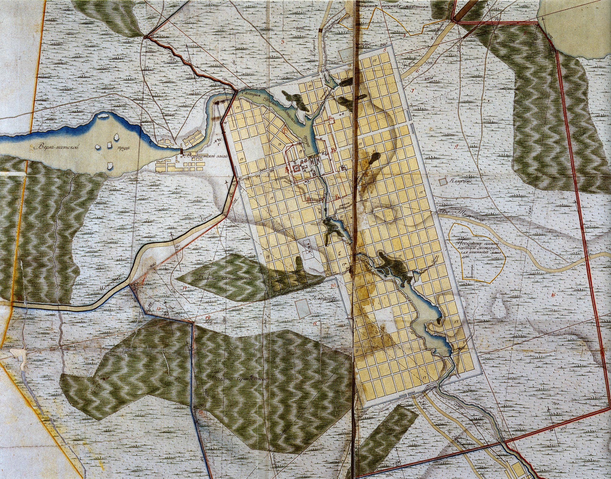
Card 1730
(A city map of Ekaterinburg of 1730th the Card is published in the book "Ekaterinburg a city history in architecture". Publishing house "Socrat" 1998)
-
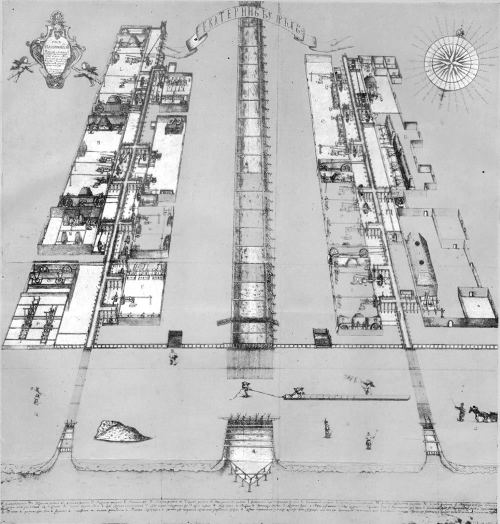
Card 1729
(A long-term plan of the Ekaterinburg factory of 1729.)
-
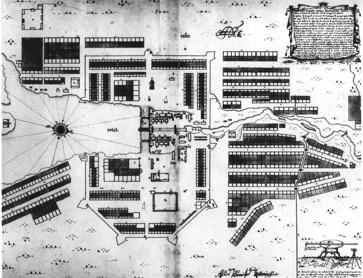
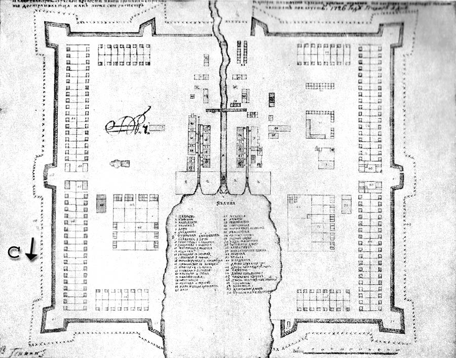
Card 1726
(The plan of the Ekaterinburg factory of 1726.)
-
Card 1723
(The plan of the Ekaterinburg factory of 1723.)
Additional sources:
http://bell.lib.umn.edu/rmaps/
http://old-map.narod.ru/
http://www.nlr.ru:8101/coll/cart/
| 
![The plan-card Odessa (?) [340 KB]](../../maps/misc/ru/odessa1.jpg)
![The plan-card Odessa (1892) [235 KB]](../../maps/misc/ru/odessa2.jpg)